

-
Recently Browsing 0 members
- No registered users viewing this page.
-
Latest Activity
-
 Can't answer you on the camping as we're always staying in Leuven at a hotel (paid $315/night this year at Park Inn), but getting back and forth is quite easy, if you don't mind the 15 min walk to/from the bus stop (it's a nice way to get sober). There are shuttles going constantly and it's basically only after the main headliner we've encountered any issues with long lines. Getting up is normally no problem no matter when.
 -
By Ayrshire Chris · Posted
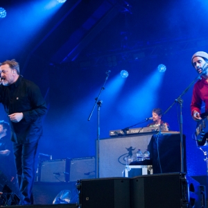
Already got tickets for their Glasgow gig, hope they do get to play Glasto again. Enjoyed their performance on the other stage. Nice bit of Americana on a sunny afternoon. -

By Pr0paneNightm4re · Posted
BCNR are gonna be touring next year but I believe later in the year so might not be in the running for glasto unless they already have other fests booked -

-
 Maybe they can have a one-two-three of tribute acts to these three for the next edition of Glastonbudget.
-
-
Latest Festival News
-
Featured Products
-
Hot Topics
-
-
Latest Tourdates


Recommended Posts
Join the conversation
You can post now and register later. If you have an account, sign in now to post with your account.